Enabling informed support
By providing accurate and up-to-date geospatial information, Geoimage's services contribute to informed decision-making, policy formulation, and environmental conservation efforts.
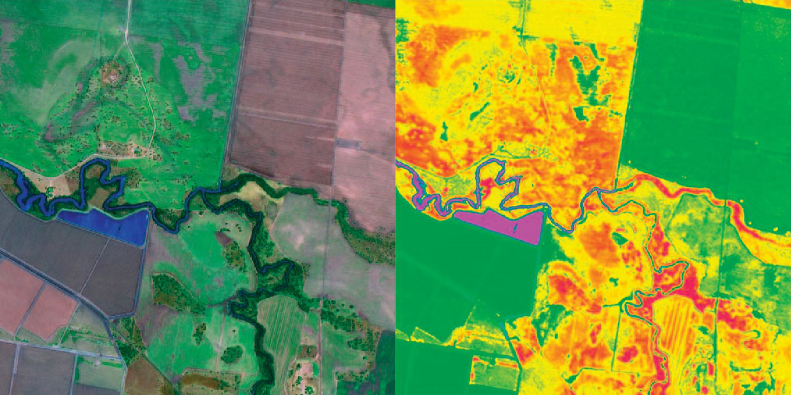
Leveraging NDVI for vegetation health
The Normalised Difference Vegetation Index (NDVI) is a widely used technique, measuring the health and density of land through visible and near-infrared (NIR) reflectance differences in vegetation.
Geoimage harnesses NDVI data to evaluate vegetation health, track growth changes, and monitor ecosystem dynamics. By providing a comprehensive overview of vegetation vitality, Geoimage empowers agencies with crucial insights for informed decisions on conservation, land management, and restoration strategies. These precise insights enable proactive prioritisation of conservation efforts and effective responses to environmental challenges.
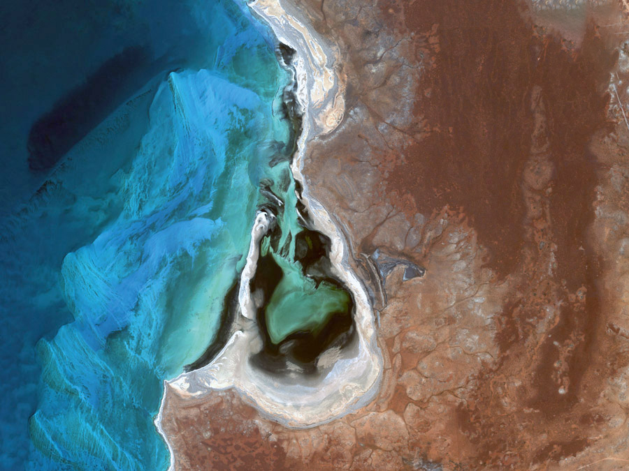
Enhancing conservation efforts with geospatial solutions
Geoimage can offer solutions to environmental agencies engaged in conservation initiatives by leveraging high-resolution satellite imagery and remote sensing technology, to aid in habitat monitoring, species distribution tracking, and protected area management.
The data provided enables evidence-based decision-making, supports policy formulation, and fosters collaboration among stakeholders. With its visual impact, Geoimage's solutions also aids in environmental education and outreach, raising public awareness about the importance of conservation, while helping agencies adapt to climate change and ensure the sustainability of ecosystems and species.
We offer a range of solutions
Our team of experts provides professional and independent advice on the acquisition and use of satellite imagery. Let us assist you in achieving your objectives with our tailored services.
InSAR
InSAR is employed for highly accurate measurement of ground displacements on the Earth's surface.
Learn moreSpectral analysis
Leverage our suite of spectral analysis tools to make well-informed decisions.
Learn moreDigital Elevation Models
Crucial for geospatial analysis, DEMs describe the 3D surface and enable orthorectification of imagery.
Learn moregroundWATCH
Our web-based dashboard for secure visualisation on enterprise GIS platforms.
Learn moreOur clients
We pride ourselves with working with the best in the industry.