Enjoy the highest clarity imagery derived from any commercial satellite
The imagery provided by 15cm HD sets a new standard in precision, unmatched by any other commercial satellite technology. With a level of detail that surpasses conventional offerings, the high-definition imagery captures the finest nuances of the Earth's surface.
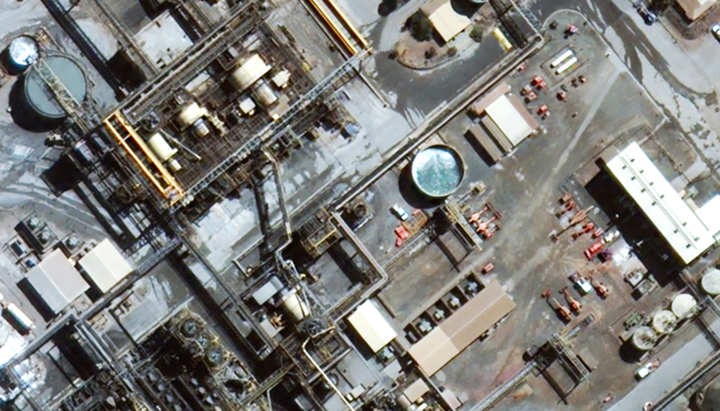
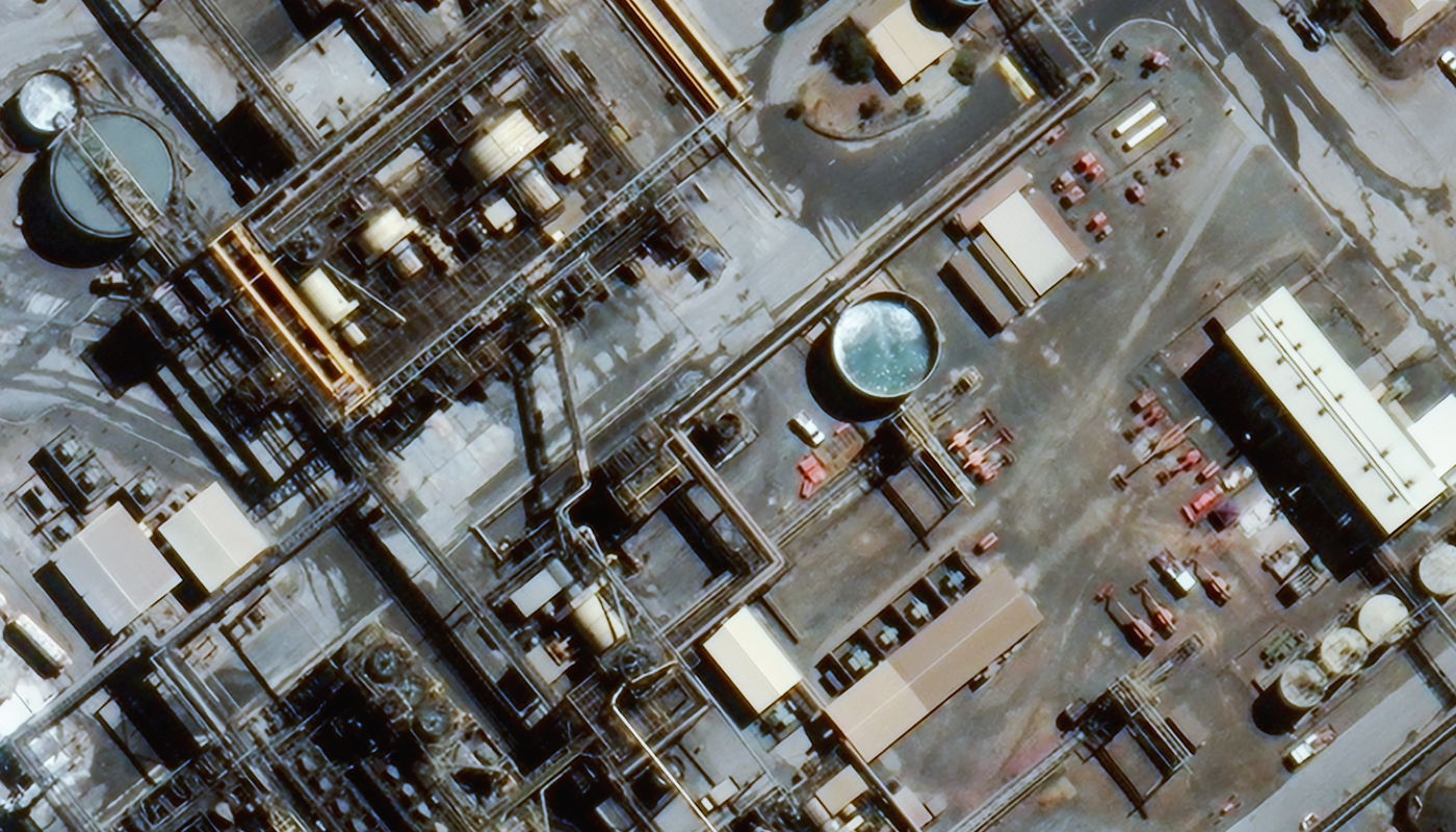
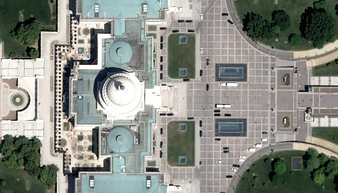
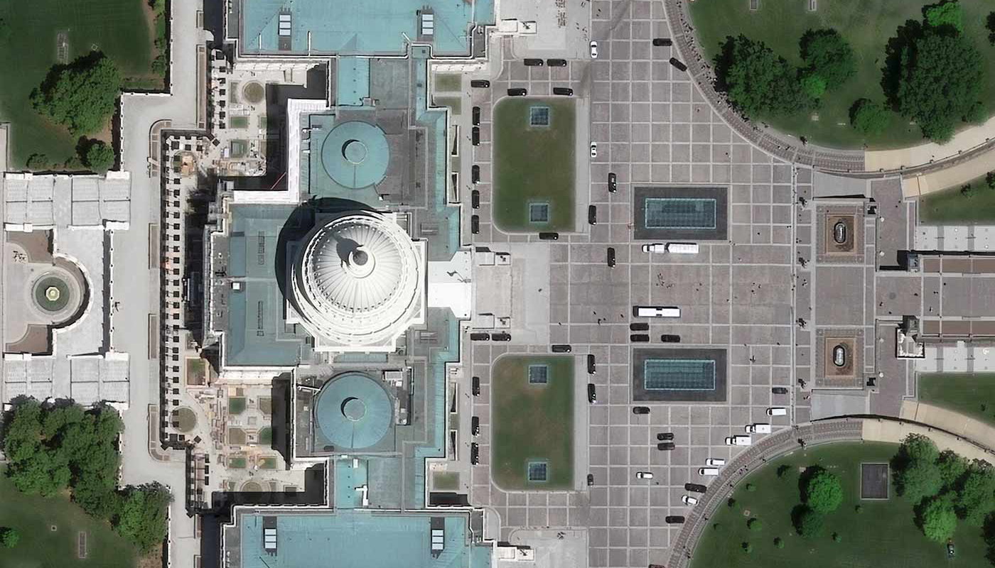
The process of generating 15cm HD involves employing specialised techniques and proprietary software on native 30cm images. Advanced HD technology employs intricate mathematical algorithms tailored to the unique characteristics of the images, effectively augmenting pixel count. This advancement yields an enhanced visual outcome, delivering distinct features that greatly facilitate the extraction of significant information by both individuals and algorithms.


Enhanced visual precision
Interpretation of images is made easier, providing superior training resources for AI or ML.

Precise identification
Enhanced degree of detail available for precise feature detection.

Rapid analysis
Rapid interpretation leads to more confident and timely decisions.

Historical archive
Access to historical imagery dating back as far as 2014.
Comparison of 15cm HD and 30cm over Capitol, Washington USA
Greater possibilities with 15cm HD imagery
Utilising 15cm HD imagery opens up countless new opportunities, such as better monitoring of critical regions, improved mapping accuracy for urban development, and increased AI/ML applications with higher resolution for accurate analysis and automation.
Monitoring
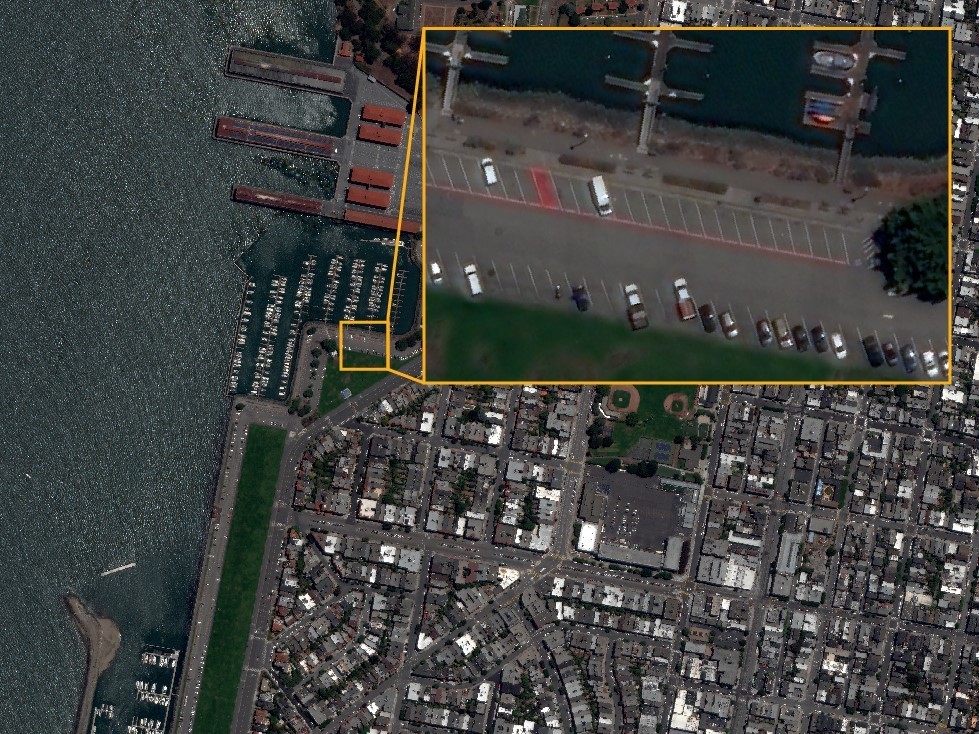
15cm HD imagery greatly enhances detail visibility in satellite images and is especially beneficial for users seeking to monitor and identify crucial areas. It offers fresh perspectives on remote locations, aiding observation of valuable assets, environment, agriculture, and temporal changes. This, in turn, minimises the need for on-site inspections, ensuring asset and personnel safety.
Mapping and urban development
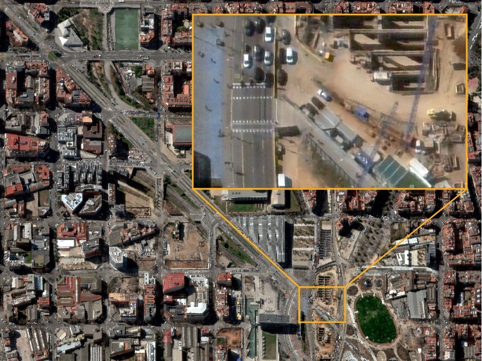
15cm HD imagery enables a level of precision that empowers governments, institutions, and businesses to authenticate various features like streetlights, signs, roadways, vehicles, and infrastructure status. All of this can be achieved without the need to dispatch teams for on-site inspections or incurring expenses related to drone usage.

AI/ML applications
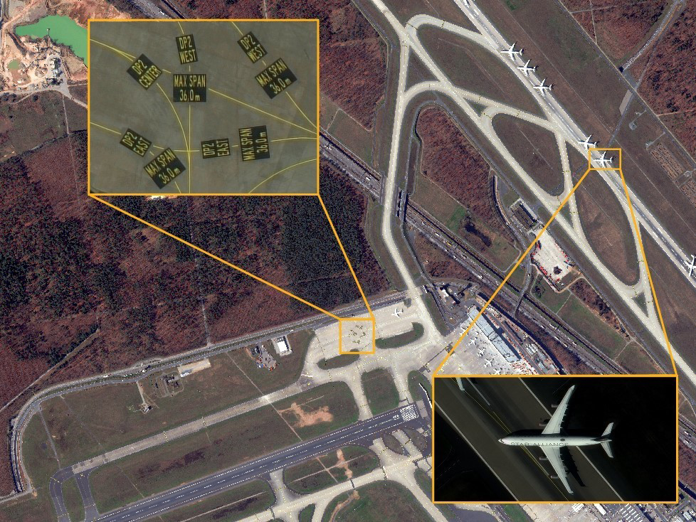
The average item detection precision of any ML/AI algorithm can be improved with 15cm HD imagery. Increased detail provided by 15cm HD data aids automated analysis, feature extraction, and change detection procedures.
Alternative to aerial solutions
15cm HD imagery offers distinct advantages in regions where conventional aircraft flights are unfeasible due to their remote nature or other disruptions affecting aerial mapping. 15cm HD imaging, with its larger coverage, emerges as the optimal alternative for large-scale projects, outperforming traditional aerial approaches.
Comparison of 15cm HD and 30cm over a mine in Australia