Leading provider of tailored geospatial solutions
Geoimage has been a trusted provider of value-added products and services to the global mining and exploration sector for over three decades. Regardless of whether the requirements involve exploration, operations, safety, environmental monitoring, or compliance, Geoimage excels in crafting customised geospatial solutions to precisely meet each client's specific needs.
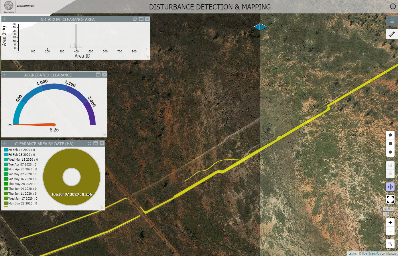
Monitoring land disturbance with satellite imagery
Geoimage offers high-resolution satellite imagery and solutions to track land disturbance, aiding mining progress, construction adherence to regulations, and sustainable land use. Detailed maps and models are created using satellite data, including Digital Elevation Models for terrain information.
By analysing imagery from different times, change detection techniques measure the rate and scale of land disruption, helping companies monitor and manage land use more effectively.
Ensuring safety with satellite monitoring
Geoimage ensures tailing dam stability and community safety by offering high-resolution satellite imagery and solutions to track structural changes like subsidence, cracks, and deformations.
Spectral analysis detects shifts in vegetation, water flow, and land use near the dam, unveiling potential hazards like flooding and erosion. The monitoring solution employs change detection algorithms displaying changes over time within your GIS, aiding in the early identification of risks.

Assessing rehabilitation progress with high-resolution satellite imagery
Evaluate the progress and effectiveness of rehabilitation efforts using accurate and detailed information.
Geoimage can provide high-resolution satellite imagery to assess the vegetation cover and ground conditions of rehabilitated areas. This information can be used to determine the success of rehabilitation efforts and identify areas that may require further attention.
Geoimage can perform spectral analysis on satellite imagery to provide information on soil quality, moisture content, and other important factors that influence the success of rehabilitation efforts.
Let Geoimage map the distribution of native and invasive species to ensure you remain compliant with environmental commitments.

We offer a range of solutions
Our team of experts provides professional and independent advice on the acquisition and use of satellite imagery. Let us assist you in achieving your objectives with our tailored services.
InSAR
InSAR is employed for highly accurate measurement of ground displacements on the Earth's surface.
Learn moreSpectral analysis
Leverage our suite of spectral analysis tools to make well-informed decisions.
Learn moreDigital Elevation Models
Crucial for geospatial analysis, DEMs describe the 3D surface and enable orthorectification of imagery.
Learn moregroundWATCH
Our web-based dashboard for secure visualisation on enterprise GIS platforms.
Learn moreOur clients
We pride ourselves with working with the best in the industry.


