What is a Digital Elevation Model?
Digital Elevation Models (DEMs) play a crucial role in geospatial analysis. A DEM is a digital representation or 3D model of a terrain's surface, generated using 3D data. At Geoimage, our internal processing team can provide two types of DEMs (DSM or DTM) for your satellite imagery, based on your specific needs.
Digital Surface Model (DSM)
This type of DEM depicts the Earth's surface and includes all objects present on it. It incorporates the heights of cultural features like buildings, roads, and vegetation, as well as the bare ground.
Digital Terrain Model (DTM)
This variant of DEM represents the bare ground surface with all cultural features, such as buildings and trees, removed.

Tailored DEMs to meet your project's unique needs
Based on your specific needs and the project's requirements, Geoimage will suggest a suitable DEM solution. We offer DEMs that can be generated from either Stereo or Tri-stereo imagery. Additionally, we can provide AW3D from RESTEC as an alternative option.
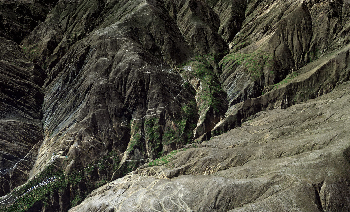
Stereo DEMs are generated using a pair of images, which allows for the creation of an 3D model by considering both forward and backward angles. This approach minimises the chances of missing any surface or terrain details. Stereo imaging is the widely employed method for capturing areas from ground level, as it typically encounters fewer obstructions. However, for capturing sub-level data in mine sites, volcanoes, and glaciers, a near-nadir capture is often necessary as well.
Tri-stereo DEMs offer higher accuracy in 3D modelling compared to stereo image pairs. Tri-stereo consists of three nearly simultaneous images that are combined to create a precise and detailed DEM. The target area is captured from three different directions: backward, forward, and near-nadir. This approach enables more accurate retrieval of elevation values across terrains, ensuring enhanced accuracy and detail without the risk of overlooking hidden objects.
AW3D is an archival 3D model that provides highly accurate and detailed 3D data of cities, terrains, ground undulations, and various global land areas. It is a valuable resource for applications such as urban planning, map creation, resource development, disaster prevention, and infrastructure development, among others. AW3D is based solely on archive data, allowing for significantly faster turnaround times compared to acquiring standard 3D models.
WorldDEM™ Neo - WorldDEM™
With unique data quality and level of detail, both elevation models facilitate a wide range of applications such as line-of-sight analysis, hydrological modelling, satellite imagery orthorectification, and much more.
Worldwide availability makes them the most robust reference layers for risk assessments and investigating global phenomena.
WorldDEM Neo sets a new standard for global Elevation models in terms of resolution and up-to-date, fresh data acquisitions (2017-2021), combined with high quality and accuracy from the well-established WorldDEM.
- Up-to-date global coverage (pole-to-pole)
- Very high resolution: 5m pixel spacing for every spot on Earth
- Very high vertical accuracy (2m relative / 2.5m absolute)
- Off-the shelf availability
Read more about WorldDEM Neo here.
Worldwide availability without any access restrictions
Large area coverage
Fast processing time
Some common uses of DEMs
- Extracting terrain parameters
- Modelling water flow or mass movement
- Creation of relief maps
- Terrain analysis in geomorphology and physical geography
- Flood modelling
- Watershed analysis
- Engineering and infrastructure
- Contour generation
- Slope analysis for bushfire risk
- Mobile network analysis
Enhance elevation mapping with AW3D data
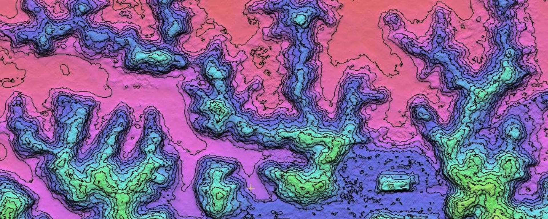
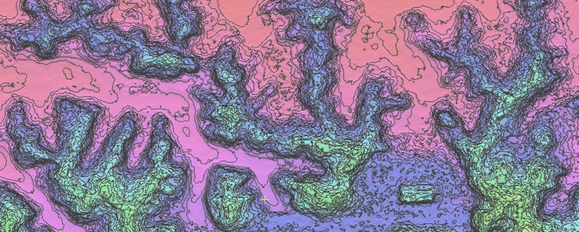
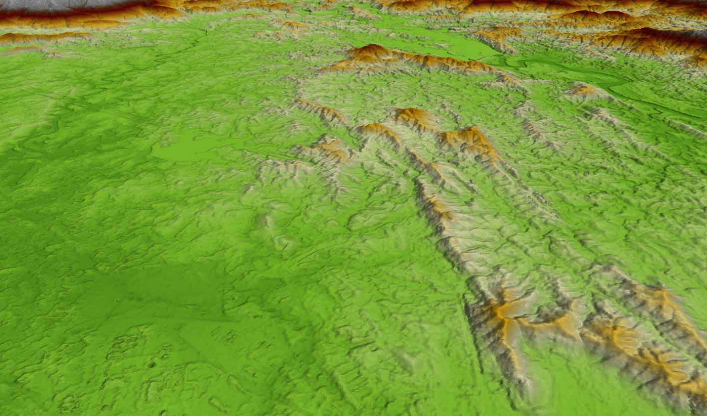
Geoimage acquires AW3D data as an off the shelf product from one of our key satellite partners, RESTEC. As AW3D is based off archive data only, the turnaround time is much quicker than acquiring standard 3D models. Below is an example of AW3D data provided by RESTEC which has been overlaid with 2.5m and 5m contours by Geoimage.