groundWATCH: Empowering you with precision
groundWATCH is a cutting-edge platform that combines satellite imagery, remote sensing, and advanced analytics to deliver highly accurate and up-to-date information about your land use and assets. Geospatial locational accuracy to within 30-50cm provides the unrivalled positional accuracy from space that is essential for your location-based decisions. Whether you are invested in infrastructure development, mining, agriculture, or environmental management, groundWATCH offers a comprehensive suite of tools to optimise your operations and mitigate risks.
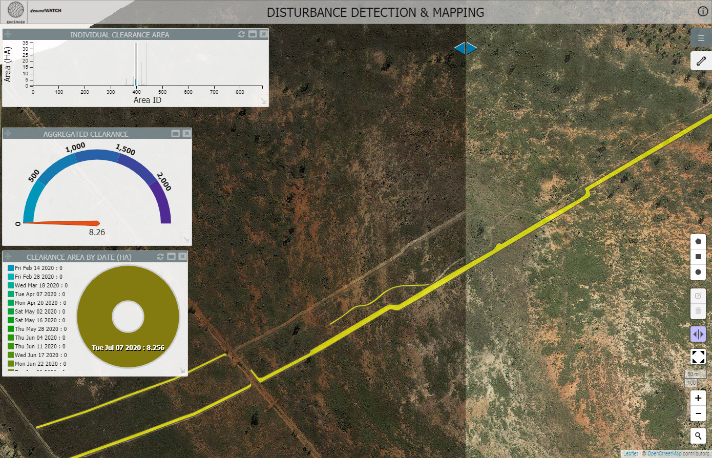
Discover automated change detection with groundWATCH from Geoimage
Why choose groundWATCH for your next project

Monitoring made easy
Stay informed with regular monitoring of ground conditions. groundWATCH provides timely updates and alerts, allowing you to make proactive decisions and respond swiftly to changes.

High-resolution satellite imagery
Leverage your access to a vast library of high-resolution satellite imagery to gain detailed insights into your area of interest. With pixel-perfect accuracy, you can identify patterns, detect changes, and effectively analyse trends.

Customisable dashboards
Tailor your monitoring experience with intuitive and customisable dashboards. Display the information that matters most to you, and access it anytime, anywhere, from any device.

Advanced analytics
Unlock the power of advanced analytics with powerful algorithms. Seamlessly analyse data, extract meaningful patterns, and generate actionable reports to optimise your decision-making process.

Data security
Our state-of-the-art servers, located in Australia, ensure the utmost security and protection of your data.

Expert support
Our team of experienced geospatial professionals are dedicated to assisting you at every step. From onboarding to expert advise on interpretation of satellite data, we provide comprehensive support to ensure you get the most out of groundWATCH.
Get started with groundWATCH today!
Join the growing community of businesses and organisations that trust groundWATCH for their geospatial monitoring needs. Experience the power of cutting-edge technology and gain a competitive edge in your industry.
Contact us today to schedule a demo and learn how groundWATCH can revolutionise the way you monitor your assets and land resources.