Most types of raw satellite imagery require some form of geometric correction or rectification to ensure that the image corresponds to real-world map projections and coordinate systems. Geoimage’s expert processing team can provide a range of services to correct and enhance your satellite imagery solutions.
Orthorectification
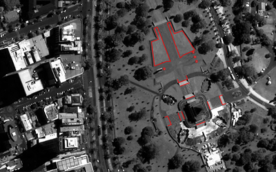
Our procedure improves the accuracy of the horizontal positioning in the images by aligning them with the precise ground control provided by the client or by utilising the internal location data from the satellite. Additionally, we incorporate a suitable Digital Elevation Model (DEM) to accommodate for variations in the terrain of the area. Our team possesses extensive expertise in both System Orthorectification and Orthorectification using Control. Moreover, if the client does not have an appropriate DEM, we have access to our own in-house DEMs to ensure a superior final output.
Pan-sharpening
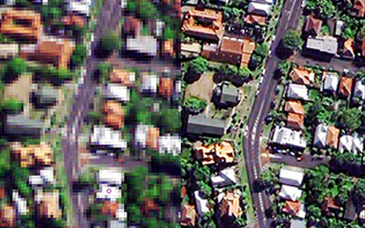
The majority of very high-resolution and medium-resolution satellites utilise a single high-resolution panchromatic (pan) band in addition to multiple lower-resolution multispectral (multi) bands. The pixel size of the multispectral data is typically a multiple of the pixel size of the pan band.
At Geoimage, we have developed a refined method of combining these datasets to produce a colour image that presents the detailed features of the panchromatic image. This approach results in a high-quality colour image that is well-suited for a variety of applications, such as vegetation mapping or as a backdrop for vectors. Furthermore, the higher spatial resolution of this colour image enables you to observe more details.
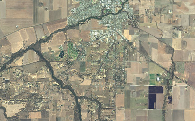
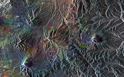
Mosaicking and Colour-balancing
Mosaicking is a critical process that involves stitching two or more images into a single, easy-to-manage dataset, creating a larger and more comprehensive image. Throughout this process the colour balancing of each dataset is iteratively adjusted to produce a visually seamless image that enhances the features that are important to you.
At Geoimage, we have perfected our expertise in this field by creating large-scale mosaics. Some of our notable accomplishments in this area include recurring whole-of-state mosaics of New South Wales and Victoria. With our expertise, dedicated hardware and specialised software, you can trust we will produce the highest quality mosaics tailored to your needs.
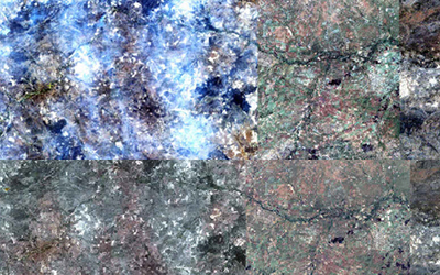
Haze removal
In certain parts of the world, haze and smoke can be a frequent issue when capturing images. Although some areas may be affected, high-resolution image operators often do not believe that haze is a significant enough problem to deter them from purchasing new imagery using the 0-5% or 0-10% cloud rules.
At Geoimage, we understand the challenges of dealing with haze in colour imagery and have developed cutting-edge techniques that minimise its impact in our processing. With years of experience and state-of-the-art software, we are dedicated to providing our clients with high-quality results.
Calibration
Calibrated satellite data is commonly utilised in remote sensing applications to enable the detection of changes in multi-temporal images. We have developed appropriate ratios and algorithms, such as Atmospheric Correction, Filtering, and Enhancements, that can maximise the potential of your data. By utilising these methods, we can obtain the most accurate and useful information possible, enabling us to provide you with high-quality results.
Reprojection
The world is home to numerous locations, each with its own unique set of datum and projections. Datum and projections play a crucial role in coordinating geospatial data effectively.
At Geoimage, we prioritise understanding our client's specific requirements for each project, ensuring that we deliver precise data. Datum and projections are essential components in achieving this objective.
Typically, we receive data in WGS84 UTM format. However, we always tailor our approach to meet our client's needs by reprojection. This allows us to provide accurately located data in the formats that best suit their requirements, even accommodating multiple reprojections if necessary.

Exporting suitable file formats
Successful loading of GIS or Geospatial software relies on specific file formats. Some widely used programs include ArcGIS, MapInfo, Imagine, Google Earth, Global Mapper, and QGIS.
At Geoimage, we possess a range of software packages designed to verify file formats during quality control (QC) processes. Additionally, these software packages enable us to export data in precisely the format you require, ensuring compatibility and seamless integration with your chosen software.