Unveiling Earth's surface changes with radar precision for enhanced decision-making
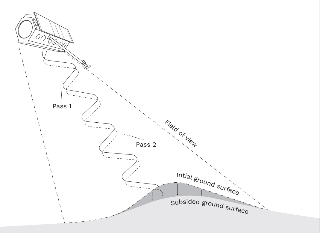
InSAR (Interferometric Synthetic Aperture Radar) is a remote sensing technique that uses radar data to measure and monitor changes in the Earth's surface. InSAR involves the use of two or more radar images taken from slightly different positions to create an interferogram, which is a visual representation of the phase difference between the radar signals.
The interferogram shows areas of the Earth's surface that have experienced deformation, such as subsidence or uplift. By analysing the interferogram, you can measure the magnitude and direction of these surface changes with high precision.
The data obtained from InSAR can provide valuable information for understanding geological processes, assessing risks, and informing decision-making in areas such as urban planning, infrastructure development, and environmental management.
See through clouds and smoke
Allows clear visibility even in obscured environments such as cloud cover or smoke, enabling efficient navigation and surveillance day or night.
Detects small movements
Capable of detecting movements as minute as 1-2mm, making it an invaluable tool for precision tracking and monitoring.
Unlocking the power of InSAR
InSAR has various applications in geology, environmental monitoring, and natural hazard assessment. It is a valuable tool for studying and tracking various phenomena, including earthquakes, volcanic activity, land subsidence, glacier movement, and ground displacement caused by mining or underground resource extraction.
By utilising InSAR, it becomes possible to regularly monitor solid surfaces like bunds, open pits, and sparsely vegetated ground, as well as manmade structures such as tunnels and bridges. These monitoring activities can be conducted at intervals of approximately 11-12 days, enabling consistent observations over months and years.
One of the notable capabilities of InSAR is its ability to measure vertical surface movements with a high level of precision, down to a range of 1-2mm. The resolution of the ground imagery captured depends on the satellite sensor employed, ranging from 20m to as fine as 1m.
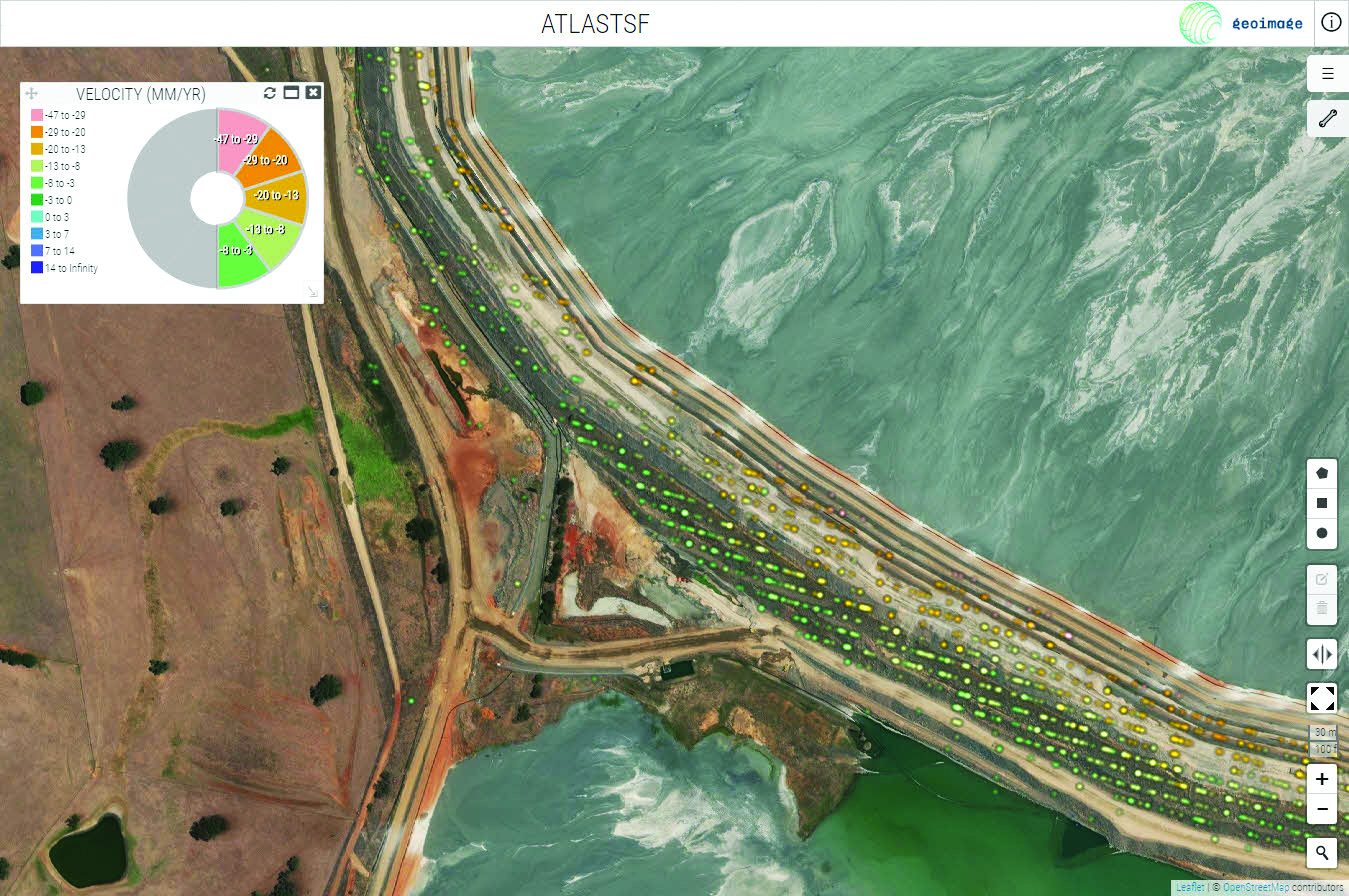
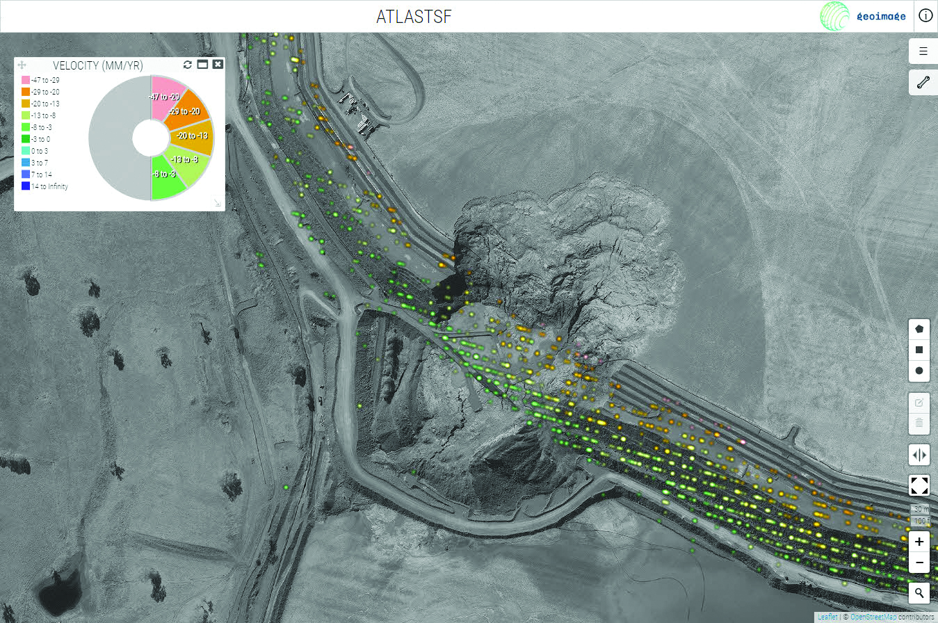
The image shows before and after high-resolution satellite imagery overlaid with InSAR data captured over the Cadia Mine in January and February of 2018, a month before the breach of the tailings dam wall.